Livingston Road over Piscataway Creek. Prince George’s County, Maryland.
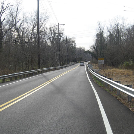
WRA performed highway, bridge, and traffic studies and provided preliminary engineering design for the replacement of an existing two-span reinforced concrete T-beam bridge carrying Livingston Road over Piscataway Creek. The proposed replacement bridge consists of a two-span prestressed concrete girder bridge that will significantly increase the hydraulic opening, thereby reducing the frequency of the approach roadway overtopping and eliminate a scour potential. In order to achieve the increase in the hydraulic opening, the profile of Livingston Road is being raised approximately 6 feet. The bridge will be replaced using a full detour of Livingston Road. The proposed bridge layout avoids conflict with an existing 54 inch and 36 inch sanitary sewer. Geofoam blocks is proposed in the additional fill material over the existing sanitary sewers to achieve the raised profile.
Services Performed
Project Highlights
Bridges
The replacement bridge consists of two 75 feet spans and a prestressed concrete girder superstructure. The superstructure will provide 1 foot freeboard over the 25-year storm water surface elevation. The bridge will support a relocated water main impacted by the construction.
Highways/Roadways
The Livingston Road horizontal alignment will be similar to the existing alignment. The vertical alignment is being raised to increase the hydraulic opening of the bridge. The new roadway will carry two 12 foot travel lanes with 6 foot shoulders.
Traffic
A Maintenance of Traffic Alternative Analysis was performed to verify the level of service of the roadways and intersections being used to detour the traffic during the replacement of the Livingston Road Bridge.
Water Resources
The hydraulic opening will improve from being able to pass a 2 year storm without overtopping the approach roadways to passing a 25 year storm with 1 foot freeboard. Stormwater management design will employ the use of bioretention facilities along the roadway.
Mapping/GIS/Surveying
Survey for the project consisted of boundary surveys to locate existing right-of-way, topographical survey of the existing conditions, and survey of environmental resource boundaries. Survey was tied to the Maryland State Plane Coordinate System (NAD 83/91) and NAVD 88 datum.
Geotechnical
Preliminary geotechnical engineering for this project has revealed the possible use of caisson foundations for the replacement bridge. Use of a geofoam blocks in the approach roadway embankment will eliminate additional surcharge on existing sanitary sewers.
Environmental
WRA will be completing all field work and documentation required to secure authorization and permitting from local, state and federal agencies, which include wetland permitting (USACE & MDE), Forest Stand Delineation/Conservation Plan (M-NCPPC), and NEPA compliance (FHWA).