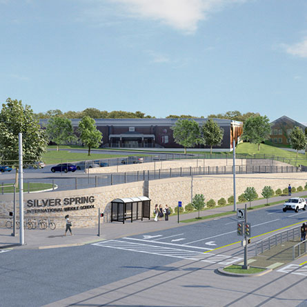
Maryland National Capital Purple Line. Montgomery and Prince George’s County, Maryland.
The Purple Line will extend between Bethesda in Montgomery County and New Carrollton in Prince George’s County. It will connect both branches of the Washington Metrorail Red Line at Bethesda and Silver Spring, the Green Line at College Park, and the Orange Line at New Carrollton; all three MARC commuter rail lines; local and regional bus systems; and Amtrak’s Northeast Corridor. The purpose of the proposed project is to provide faster, more direct and more reliable east-west transit service between the major activity centers at Bethesda, Silver Spring, Takoma/Langley Park, College Park, and New Carrollton. The Purple Line will be largely surface-running, on or adjacent to, existing roadways. As the General Engineering Consultant, WRA was responsible for the overall project management and was leading efforts for many of the project elements. This project was Maryland’s first Public Private Partnership transit project.
Services Performed
Project Highlights
Environmental
WRA was responsible for the preparation of the Final Environmental Impact Statement and Section 4(f) Evaluation for the 16-mile Preferred Alternative. WRA led several of supporting technical studies including Land Use and Socio Economic studies, Neighborhood and Community Impacts, Parks, Recreation and Open Space Impacts, Air Quality, Utilities, Hazardous Material Investigations and Construction Impacts. WRA was responsible for regulatory coordination meetings with the National Park Service, National Capital Planning Commission, and US Fish and Wildlife Service.
Transit
WRA designed approximately 4.3 miles of the transitway beginning at the terminal station of Bethesda to Silver Spring. The design integrated the Purple Line with a shared-use path and CSX within a highly developed commercial and residential area, while minimizing impacts to environment and community.
Architecture
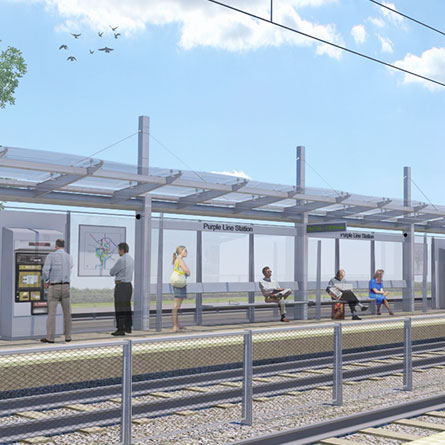
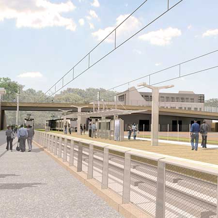
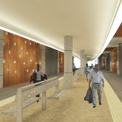
WRA lead the planning and architectural design of 21 stations ranging from at-grade station locations to complex aerial station design, including integrating stations within infrastructure that exists or is currently under design or construction.
Traffic
WRA was responsible for the preparation of many traffic operational studies assessing impacts to motorists, pedestrians and transit service following construction. In addition, WRA was responsible for the development of the corridor wide Transportation Management Plan.
Maintenance Facility Planning and Design
WRA led the planning and design of two yard and shop facilities for the Purple Line, including the development of the overall program requirements. The footprint of the Lyttonsville Yard and Shop was minimized in an effort to reduce the impact to the adjacent light industrial and residential community.
Geotechnical
WRA managed the subsurface investigation that consisted of over 600 borings. Preliminary Geotechnical Engineering Reports were provided for 40 bridges and over 70,000 LF of retaining walls. A Geotechnical Data Report was provided for the 1,000 foot long SEM tunnel.
Bridges
WRA was responsible for all structures along the 16.3-mile corridor, which includes FIVE signature bridges, 35 bridges, over 70,000 LF of retaining walls and a 1,000 foot long SEM tunnel, two maintenance buildings, and parking structures.
Mapping/GIS/Surveying
Potential environmental impacts throughout the transit corridor were identified and quantified through GIS analysis. GIS was the source of high quality graphics generated for state and federal reporting and public information meetings.