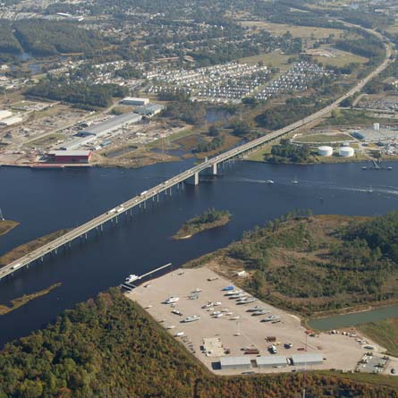
I-64/High Rise Bridge Corridor Study Environmental Assessment. City of Chesapeake, Virginia.
I-64 is the only interstate highway providing access into and out of Hampton Roads for the approximately 1.7 million people living in the region and provides access to numerous tourist destinations, along with 15 military installations in the region. It also serves freight movement to and from the port facilities in the region.
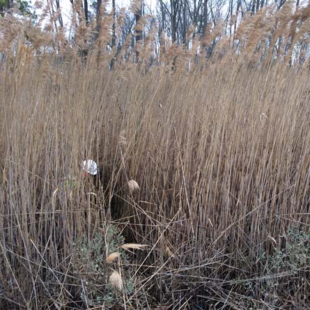
WRA was responsible for conducting the wetland delineation along the Interstate 64 Corridor. WRA advanced shovel test pits and prepared data sheets in accordance with US Army Corps of Engineers 1987 Corps Wetland Delineation Manual and Regional Supplement to the Corps of Engineers Wetland Delineation Manual: Atlantic and Gulf Coastal Plain Region. This information was used to support findings presented in the Natural Resource Technical Report.